
The National Weather Service relies heavily on satellites to provide its weather forecasts as well as important water and climate data. The National Oceanic and Atmospheric Administration (NOAA) operates these satellites and works with NASA to build them. NOAA also works with the Department of Defense on weather technology and relies on DOD weather satellites to produce forecasts. There are also international partnerships that expand and enhance the amount of data available for weather and climate forecasting.
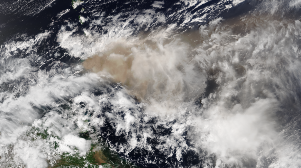
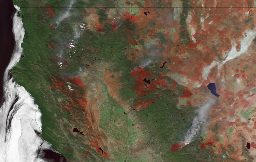
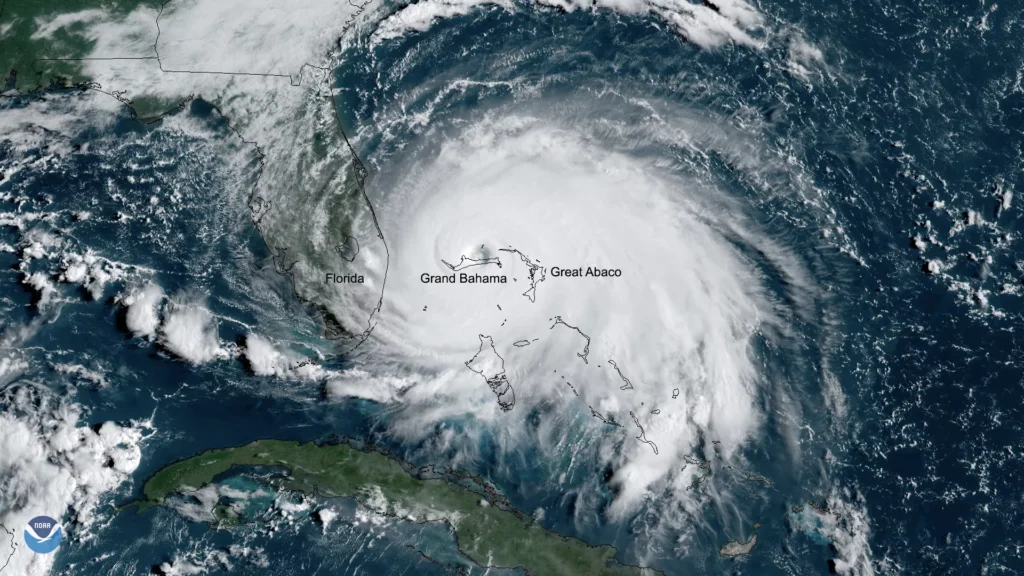
There are two types of weather satellites: polar orbiting and geostationary. Both systems have unique characteristics and produce very different products, according to the National Weather Service. Polar orbiting satellites observe the same spot on the Earth twice daily and provide imagery and atmospheric soundings of temperature and moisture data over the entire Earth. Geostationary satellites are in orbit 22,000 miles above the equator, spin at the same rate of the Earth and constantly focus on the same area. This enables the satellite to take a picture of the Earth, at the same location, every 30 minutes. During severe weather outbreaks, the geostationary satellites can be commanded to focus on a smaller area, taking pictures every 5 to 15 minutes.
NOAA owns 10 satellites and operates 6 others
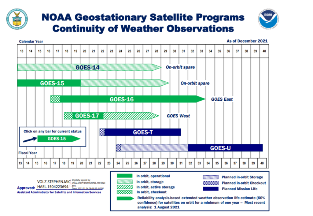
- NOAA owns 5 geostationary (GOES-14, 15, 16, 17, 18)
NOAA has been developing and operating Geostationary Operational Environmental Satellites (GOES) since 1975, but the early satellites could only view earth about 10 percent of the time, as opposed to the constant monitoring the satellites can provide today. The third satellite in the GOES-R series, known as GOES-T, was launched in March 2022. It will cover the Western Hemisphere. The next satellite, GOES-U will be launched in 2024.
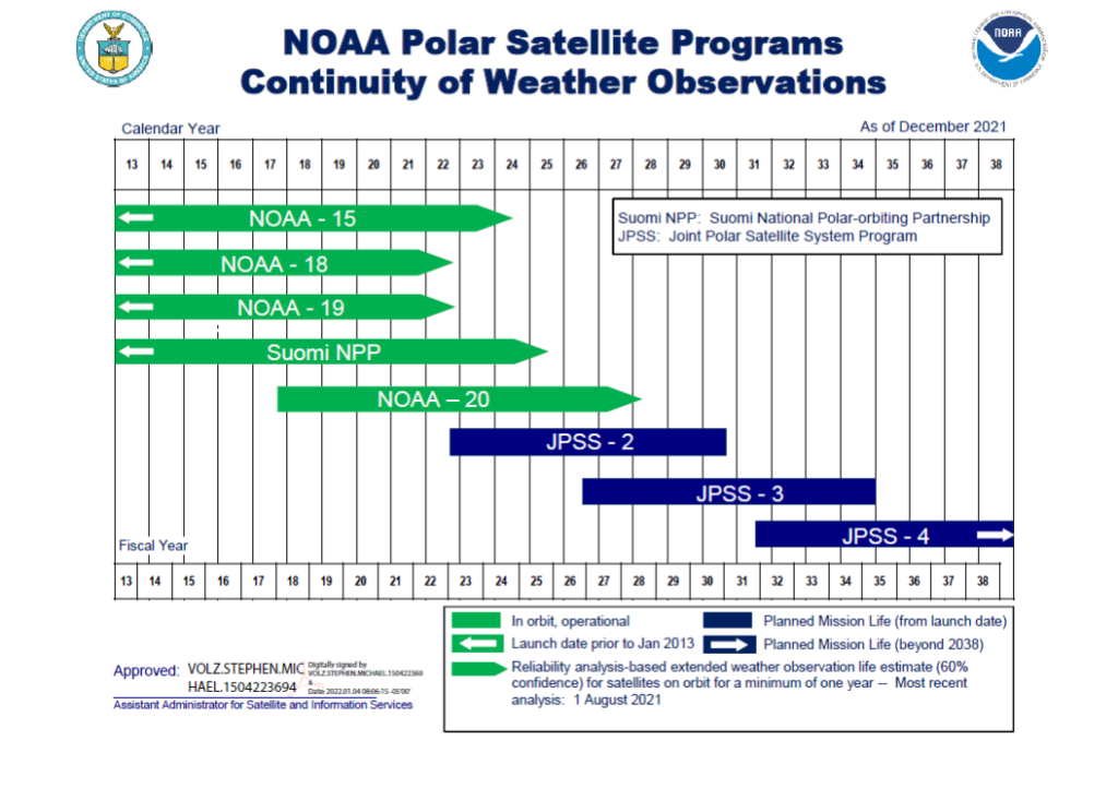
- NOAA owns 4 polar orbiting (NOAA-15, 18, 19, 20)
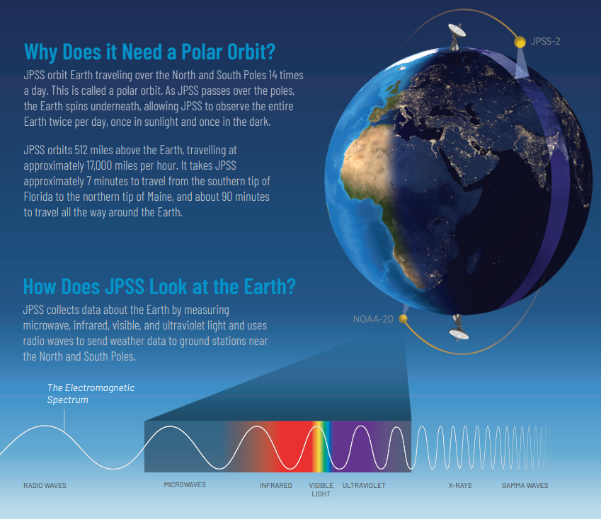
Polar satellites circle the Earth pole to pole and cross the equator about 14 times daily. The ones that NOAA develops and owns, Joint Polar Satellite System satellites (JPSS), cross the equator in the afternoon orbit. (The ones that DOD developed, DMSP, cross in the morning and European polar satellites, Metop, cross mid-morning). The next JPSS satellite (JPSS-2) is expected to launch in September 2022. There will be 2 more JPSS satellites to follow.
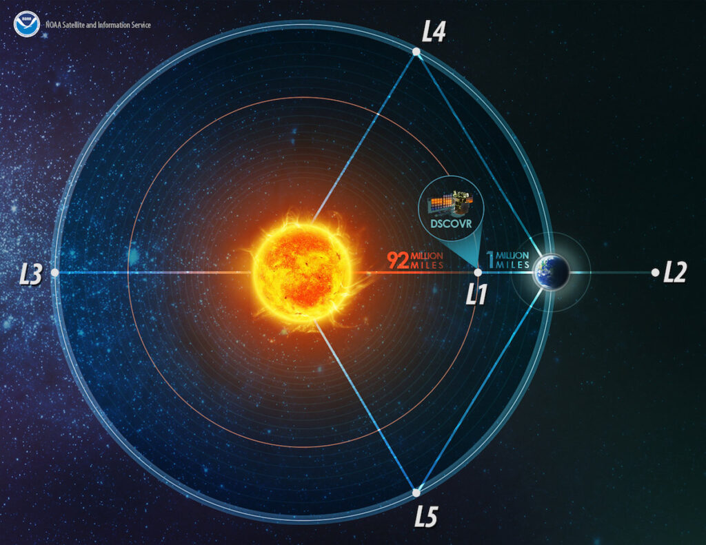
- NOAA owns the Deep Space Climate Observatory, or DSCOVR, satellite
This is a space weather satellite that was built in the 1990s by NASA for Earth science. The satellite was put into storage in 2001 after the NASA mission was canceled, but it was removed from storage years later after it was determined it could help meet NOAA and DOD’s space weather requirements. DSCOVR gives real-time solar wind observations so that forecasters can provide early warnings about geomagnetic storms. Acting like a sensor buoy at sea that warns of an oncoming tsunami, DSCOVR can warn forecasters 15 to 60 minutes before solar storms reach Earth, according to NASA. DSCOVR was the first Falcon 9 payload SpaceX flew for DOD.
- NOAA operates the Suomi NPP satellite, which is owned by NASA
Suomi NPP was originally meant to be a demonstration satellite under the National Polar-orbiting Environmental Satellite System program (NPOESS)—a NASA/NOAA/DOD effort to build new polar orbiting satellites—which was canceled in the face of significant delays, cost overruns, and management challenges. After the cancelation, it was decided NPP would be an operational satellite, to help ensure continuity between the legacy satellites and JPSS.
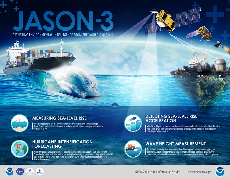
- NOAA operates Jason-3, which is owned by France’s space agency, CNES
JASON-3 is used to monitor sea levels. The development of the satellite was a joint effort among NOAA, NASA, France’s space agency, Centre National d’Etudes Spatiales, and the European Organization for the Exploitation of Meteorological Satellites (EUMETSAT).
- NOAA operates 3 Defense Meteorological Satellite Program (DMSP) satellites
DMSP satellites are polar-orbiting satellites built by DOD. The first DMSP satellite was a classified program built by the National Reconnaissance Office and launched in 1962. DMSP operations were transferred to NOAA in 1998 but the Air Force still funds the development of its own weather satellites. (Note–the NOAA website indicates that NOAA operates F-16, 17 and 19 DMSP satellites but F-19 had a power failure in 2016 that ended its operations. The failure left F-16, 17 and 18–all past their lifespan–operational).
- NOAA operates EWS-G1, a former GOES satellite that was transferred to the Air Force
This satellite, formerly GOES-13, was developed by NOAA and launched in 2006 and provided weather coverage over the U.S. East Coast for 10 years before being replaced by GOES-16. The satellite was transferred to the Air Force in 2019 and now covers the Indian Ocean. NOAA operates the satellite on behalf of the DOD.
Weather Satellites in Development
NOAA is working on developing a disaggregated architecture of smaller low-earth orbiting satellites to provider greater overall system reliability, resilience, and agility compared to the larger satellites of the JPSS era. NOAA plans to use demonstration missions to prove out this new smallsat architecture. NOAA is also working GeoXO, a follow-on to the GOES-R program. GeoXO will advance weather, ocean, and climate observational capabilities. NOAA is also developing the Space Weather follow-on satellite, which is expected to be launched in 2025 and it is in the early stages of developing the Space Weather Next satellite. In addition, NOAA is working on a common ground system architecture.
Weather satellite budgets and costs

DOD is developing two Weather System Follow on satellites, which will partly replace DMSP (Cost about $1 billion). The first satellite is planned to be ready for launch in 2023. It is also developing new electro optical infrared weather sensors.
Additional Information/Sources
- Home | National Environmental Satellite, Data and Information Service (NESDIS) (noaa.gov)
- National Oceanic and Atmospheric Administration FY 2023 Congressional Budget Submission (commerce.gov)
- Office of Satellite and Product Operations (noaa.gov)
- In Depth | DSCOVR – NASA Solar System Exploration
- Fact Sheets (af.mil)
- Also relied on information from Schriever Air Force Base website, GAO’s annual assessments of weapon systems, media reports about DMSP F-19.